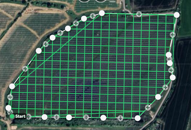
At PamphFly Drone Services, I specialize in delivering highly accurate 3D mapping solutions for real estate, construction, and land surveying projects. Using state-of-the-art drone technology, I collect precise data to create detailed and realistic models of your sites. Whether you’re planning a development, assessing land, or presenting proposals, my mapping services provide the accuracy and clarity you need to make informed decisions.
My 3D mapping services are tailored to fit your specific project needs. From generating high-resolution orthomosaics to constructing elevation models, I ensure the output meets the highest industry standards. With the ability to survey large areas quickly and efficiently, I help save time and reduce costs while providing results you can rely on. Each map is carefully processed to ensure every detail is accounted for.
These services benefit clients across a wide range of industries. Architects, urban planners, and construction managers use my maps for design and analysis, while real estate developers leverage them to showcase properties from a unique perspective. With PamphFly Drone Services, you’ll gain a competitive edge through innovative mapping solutions that transform your project vision into reality.


